While driving around the Puget Sound area on a clear day, it is hard to miss the iconic view that is Mount Rainier. At over 14,400 feet in elevation, it is the largest mountain in the state of Washington. It is also considered one of the most dangerous volcanoes in the world because it is due for an eruption at any time, and is close to a huge population center.
Unbothered by its potential for violence, we were excited to visit Mt. Rainier National Park for the first time in 10 years, especially because we were anticipating getting to see the mountain from the Eastern side of the mountain known as the Sunrise Area. However, this turned out to be our shortest vacation ever, as a knee injury kept Raymond from being able to continue to camp and hike. But, that didn't stop us from taking over 100 pictures in a couple of days.
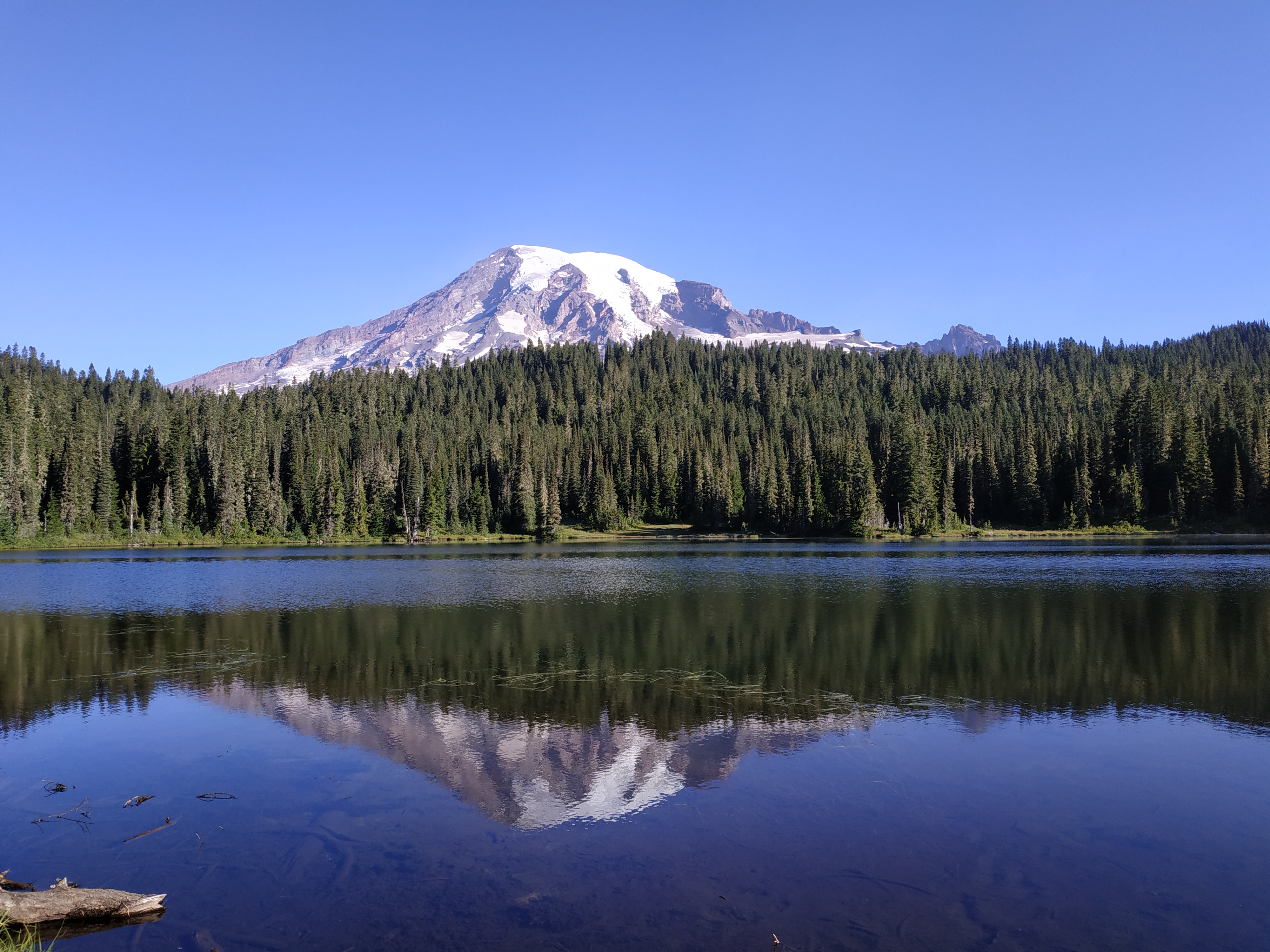
Iconic setting of Mount Rainier with Reflection Lake in foreground
Hiking
Because the trip was so short, we were only able to take four hikes:
| Hike | Approx. Elev. Gain (ft) | Distance (miles) |
| Alta Vista / Deadhorse Creek / Waterfall Trails | 849 | 3.1 |
| Carter / Madcap Falls | 1111 | 3.6 |
| Nisqually Vista Trail | 347 | 1.1 |
| Reflection Lake / High Lakes Trail | 788 | 3.2 |
| TOTALS | 3095 | 11.1 |
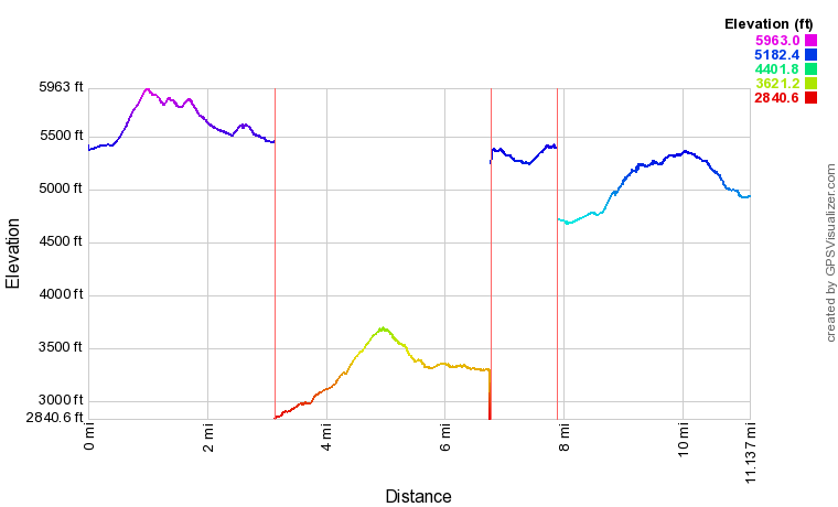
GPS Info
Here is a link to our GPX file
Maps
Elevation Profile


No comments:
Post a Comment