Also known as the Banks-Lowman highway (for the two towns that bookend this drive,) this byway follows a section of the South Fork of the Payette River which is extremely popular with kayak afficionados. There are some really nasty rapids along this stretch, and it's pretty fun to watch the kayakers bob up and down through the cascades here.
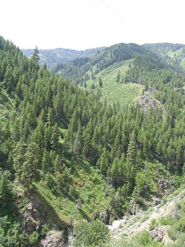
Vista from the Banks-Lowman Highway
GPS Info
We collected all of the following data from our GPS unit during the adventure:Maps
This Google Map is provided by GPS Visualizer
This profile is provided by GPS Visualizer
If you would like to use this info with your GPS unit, the full GPX file is here.
If you want to view this in Google Earth, you can download the KMZ files of the track and topographic overlay.
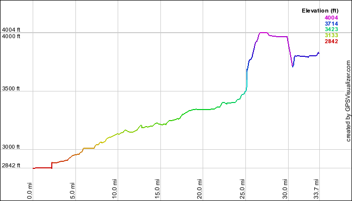
Elevation Profile
This profile is provided by GPS Visualizer
Coordinates and other details
| 33.7 Miles 59:33 34 Miles/Hr. N 44º 05.057, W 116º 06.870 N 44º 04.953, Wº 115 36.872 |
If you would like to use this info with your GPS unit, the full GPX file is here.
If you want to view this in Google Earth, you can download the KMZ files of the track and topographic overlay.


No comments:
Post a Comment