We've driven this section of the byway several times. It has been the source of our first and most frequent bald eagle sightings. The river along this stretch from Banks, ID to Horseshoe Bend, ID is a popular one for kayaks and white water raft tours. Here are some pictures from our first drive along the byway.
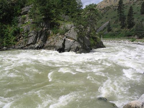
South Fork Payette River during Huge Runoff Season
GPS Info
We collected all of the following data from our GPS unit during the adventure:Maps
This Google Map is provided by GPS Visualizer
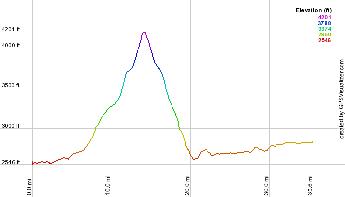
This profile is provided by GPS Visualizer
If you would like to use this info with your GPS unit, the full GPX file is here.
If you want to view this in Google Earth, you can download the KMZ files of the track and topographic overlay.
Elevation Profile
This profile is provided by GPS Visualizer
Coordinates and other details
| 35.6 Miles 42:04 51 Miles/Hr. N 43º 55.047, W 116º 11.836 N 44º 05.052, W 116º 06.867 |
If you would like to use this info with your GPS unit, the full GPX file is here.
If you want to view this in Google Earth, you can download the KMZ files of the track and topographic overlay.


No comments:
Post a Comment