Wednesday, September 1, 2010

Alaska Inside Passage Cruise

Every five years, the Lewis family decides its time to go all out on our annual family vacation.  For this splurge vacation, we opted on a cruise to Alaska.  None of us had ever been on a cruise, and none of us had ever been to the state of Alaska, and since we are so close now, living in the extreme Pacific Northwest, we were excited about the adventure.  

After much research about ports of call, trip itineraries, and cruise lines, we decided on an inside passage cruise with Holland America Lines on the ms Zuiderdam. The round trip cruise out of Vancouver presents cruisers with a quintessential look at Southeast AK, including JuneauSkagway, and Ketchikan as ports of call.  We also cruised the very scenic Tracy Arm fjord, and spent a full day in Glacier Bay National Park.  During our stay in Skagway, we rented a car and drove into British Columbia and on to the Yukon.  Amelia points out that along with our visit to Alberta, Canada on our trip to Glacier National Park, we now have visited 1/3 of all of the Canadian provinces, (even though we've still covered way less than 1% of the Canadian land!

Itinerary


Alaska Inside Passage - HAL Zuiderdam route

DayDatePortArriveDepart
03 Jul 2010Vancouver, B.C., CA 05:00 PM
14 Jul 2010At Sea  
25 Jul 2010Tracy Arm, Alaska, US 08:00 AMNoon
26 Jul 2010Juneau, Alaska, US02:30 PM10:30 PM
37 Jul 2010Skagway, Alaska, US07:00 AM09:00 PM
48 Jul 2010Glacier Bay 07:00 AM04:00 PM
59 Jul 2010Ketchikan, Alaska, US10:00 AM06:00 PM
610 Jul 2010At Sea  
711 Jul 2010Vancouver, B.C., CA07:00 AM 


Takeaways

Here are a few final thoughts from our vacation:
  • Wildlife.  It doesn't take much to see wildlife in Alaska.  We saw killer whaleshumpback whalesseals, a brown bear, dozens of bald eagles, and hundreds of sea gulls.  We were all amazed to spot a blow spout far off in the distance and then watch whales emerge and in some cases slap the water with their tails.  At one point, we are pretty sure we saw a pod of humpbacks feeding as the water seemed to churn with flailing fish.  The whales would then slap the water with their tails to stun the fish and make easy prey out of them.  It was also a blast to watch eagles dive into the ocean to catch fish.  Every single time that we saw them dive, they came up empty-handed--apparently it is no easy task.  One one occasion, however, the eagle had the fish in his talons, raised it several inches out of the water before losing its grip and letting dinner slip right back into the ocean.
  • Panorama-Rama.  On a cruise ship, everything is panoramic, especially in Alaska!  One of the panoramic shots is a nine-frame pan that was taken from the back of the ship.  Amelia encouraged Dad to take as big of a pan as possible while cruising in Glacier Bay.  He snapped nine pictures, not sure that it would work out, but it actually turned out pretty well.  Hugin to the rescue, (as always) when it comes to stitching panoramic images.
  • Weather.  When going to AK, prepare for any type of weather imaginable.  We had icy cold mists, drizzling rain, and clouds for the first 5 days straight of the cruise.  Finally, as we were leaving Glacier Bay, the sun came out, and we even "enjoyed" 80+ degree heat in Ketchikan, known as one of the rainiest cities in all of the USA.  Go figure!  

  • Cruising:  So, the jury is still out on whether the Lewis family actually enjoy the cruise ship vacation.  While, we admit that it is an outstanding way of seeing the SE Alaska scenery as it floats by, we also weren't impressed with the crowds.  It could be very difficult finding a table in the buffet room, and all of the desirable public area seating was constantly packed at seemingly all hours of the day.  We also found it annoying that there were dress codes in the evening.  "Smart casual" and "formal nights" meant that we had to pack a lot more clothes than were needed, and we found that by the end of a very busy day of sight-seeing, the last thing we wanted to do was dress up.  Fortunately, we booked a verandah stateroom, so we had our own balcony that we could relax upon and enjoy the scenery.  Not only was the verandah worth every penny, this vacation would not have been nearly as enjoyable without it.

Photos

Even though we were only gone for a week, we still managed to take over 350 pictures!  Here are our Imagebam albums from the trip:

Saturday, April 17, 2010

Blaine Geocaching


Amelia participated in the 2010 Washington state math championship, in Blaine, Wa on the Canadian border.  During her testing, the rest of the family took the opportunity to do some geocaching in the area.  While we got a little wet in the drizzling rain, we enjoyed exploring this new area, bagging a few geocaches and also catching some of the views of the Strait of Georgia.


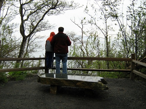
Raymond and Dad enjoy a view of the Georgia Strait from Point White Horn Marine Park


Geocaches Attempted

Traditional CacheBay WalkPassed
Traditional CacheBeach WayFound
Traditional CacheGrumblecache VII: Point Whitehorn WLTFound
Traditional CacheMersea Natives Faraway CacheNot Found
Traditional CacheMillennium TrailFound
Traditional CacheOver the EdgePassed
Traditional CachePark N Go CacheFound

GPS Info

We collected all of the following data from our GPS unit during the adventure:

Maps

This Google Map  is provided by GPS Visualizer

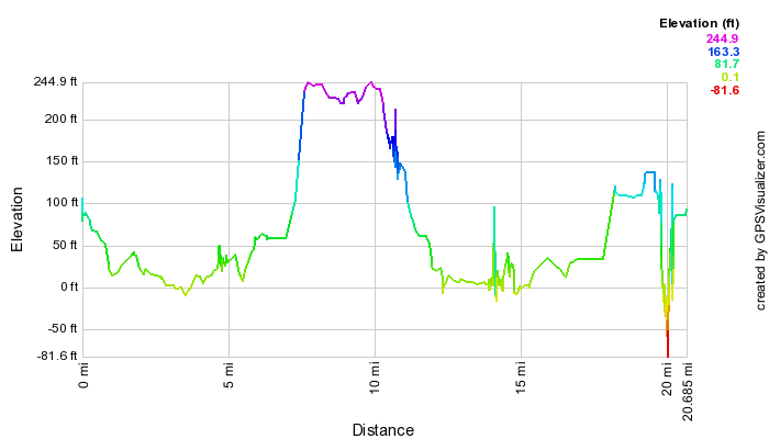
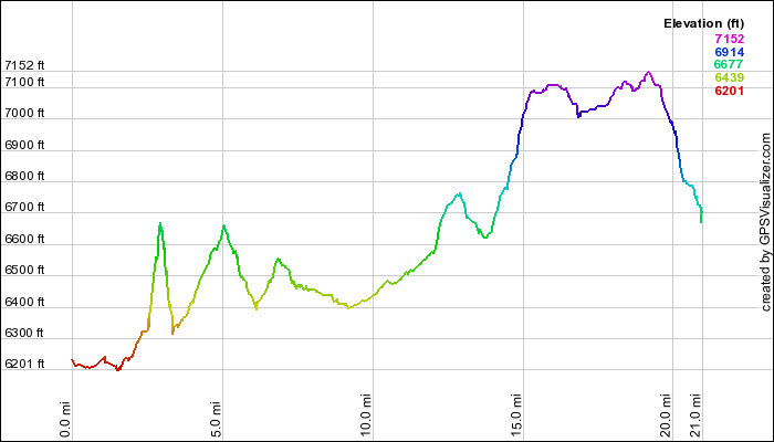
Profile

This profile is provided by GPS Visualizer

Coordinates and other details

  • Mileage:   
  • Time
  • Speed:
  • Coordinates:
20.7 Miles
2:52:12
7 Miles per Hour
N 48 59.639, W 122 44.146

If you would like to use this info with your GPS unit, the full GPX file is here.
If you want to view this in Google Earth, you can download the KMZ files of the track  and topographic overlay.

Friday, July 10, 2009

Yellowstone National Park, Wyoming

 Yellowstone has to be one of our favorite National Parks.  In our 15 years of family vacations, we have never duplicated any of our locations, but we made an exception this year in order to allow Amelia and Raymond an opportunity to see this wonder before we leave Boise, Idaho for Seattle, Washington later this summer.  (Idaho does lay claim to a small part of the park, and is a much closer drive that Washington.)  The last time the children visited this park, they were four and two years old, so they clearly didn't have any memories of the place.  They both agreed that it was well worth the return.

On this trip, we also brought Grandma Jo, who attempted a Yellowstone trip about 35 years ago, but due to snow, wasn't able to see more than Old Faithful.  She even hiked 13 of the 21 miles that we took on through both Yellowstone and Grand Teton National Park.

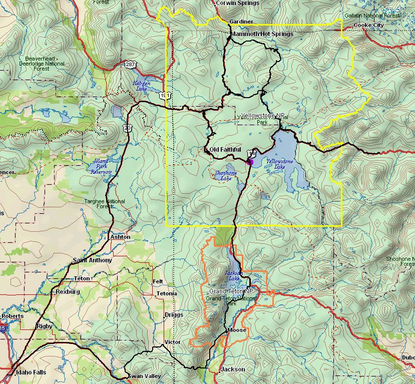
The following is a map of our trip from  Delorme Topo USA.  Yellowstone is bordered in yellow, while Grand Teton is orange.  Our travels were along the thick black lines which trace our routes through both parks.


Highlights

Here's what each family member said was their absolute favorite activity of the trip:

Raymond:Artist Paint Pots (especially the bubbling mud)
Amelia:Old Chapels in Grand Teton NP (stained glass & architecture)
Suzanne:Excelsior Geyser Crater & Grand Prismatic Pool
Mike:Geyser Eruptions (Old Faithful, Daisy, Steamboat, White Dome)
Jo Ann:Midway Geyser Basin (The Colors were amazing)

Hiking

The following table shows all of the hikes from our GPS data.  The average speed is really slow, because there is so much looking around to do at all of the thermal features.  In some cases, we waited for geysers to go off, enjoyed watching wildlife, or just took in the views.  We were impressed that even Grandma hiked 13 of the miles and tackled 1900 feet of elevation gain herself.  Here is list of all of the hikes we took on the trip.  The following is a map of all of our hikes, courtesy of GPS Visualizer:


HikeStart
Time
DurationMileage (mi)Avg. Speed (mph)Climb (ft)
Artist Paint Pots7/1/2009 15:500:43:021.12140.8
Artist Point6/28/2009 15:320:18:030.31.1118.7
Biscuit Basin6/30/2009 17:180:40:530.71.139.6
Black Sand Basin6/29/2009 11:300:25:390.61.326.4
Calcite Springs6/28/2009 13:530:12:020.21.2217.8
Fishing Bridge6/30/2009 14:580:13:070.21.15.6
Fountain Paint Pots7/1/2009 14:240:29:100.7236.7
Jackson Lake Overlook7/2/2009 13:520:10:160.3248.1
Kepler Cascades6/30/2009 17:010:06:010.223
Lewis Falls7/2/2009 11:160:10:510.3254.7
Lookout Point6/28/2009 16:270:38:580.81.3500.4
Lost Lake & Falls6/28/2009 11:321:30:512.21.4959.4
Mammoth HS Hike6/27/2009 15:361:14:461.71.4458.4
Menor's Ferry7/2/2009 14:410:31:580.61.25.1
Midway Geyser Basin7/1/2009 13:350:42:081.12109.2
Mud Volcano6/30/2009 10:290:46:510.91.2150
Norris Geyser Basin7/1/2009 9:372:04:4431.5348.3
Rescue Creek6/27/2009 18:000:05:320.11.519.9
Signal Mtn Summit7/2/2009 13:400:09:200.10.833.6
Terrace Springs7/1/2009 12:280:39:110.20.326.5
Tower Falls6/28/2009 14:080:16:540.31.271
Upper Falls Brink6/28/2009 15:590:16:150.31.1113.4
Upper Geyser Basin6/29/2009 12:173:28:4441.1204.4
West Thumb Basin6/30/2009 15:410:55:2111.173
TOTALS20:14:4820.91.373764

Takeaways

Here are a few final thoughts from our vacation:
  • Wildlife.  Yellowstone may be THE best place to experience wildlife in the contiguous 48 states!  We saw deerelkmooseblack and grizzly bearhawksbald eaglesfox, and herds upon herds of buffalo.  On at least two nights, we could hear a pack of coyotes howling while we slept in our tents.  The whole family got a kick out of the buffalo that would lead a procession of cars as slowly as it cared to along the roadways.  We even had one cross into our lane right in front of our car!
  • Panoramic scenery.  We took 35 panoramics and stitched them together afterwards with hugin.  (Thank goodness for hugin, because all those pans would be ridiculous to do by hand!)
  • Other-worldly geology.  Yellowstone has the largest concentration of hydro-thermal features, including geysers, hot springs, mud pots, and fumaroles.  But there are also deep, richly colored canyons, hexagonal basalt columns, and waterfalls, both raging and peaceful.  It is incredibly unique and one of the most fascinating National Park experiences available.

Photos

Each year, we seem to snap more picutres than the last.  Nearly 400 photos and videos in a week is ridiculous, we admit, but there are so many unique features in Yellowstone that each needed their own picture!  We split up the vacation into 6 albums, one for each day:

Tuesday, June 30, 2009

Nip and Tuck Road Drive

An interesting name for a road, we spent some time exploring this drive while it was raining.  It sure beat hanging out in the tent!  There were some great views of Stanley, ID as well as some neat old cabins.  We practically had the whole road to ourselves except for a couple of forest rangers that we passed early on.  We took an opportunity to do a little hike along here as well before it started raining to stretch our legs and enjoy a really nice view as well... so the GPS track includes both the drive and the hike.


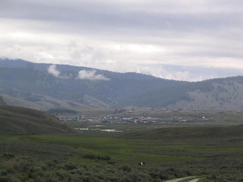
View of Stanley from Nip and Tuck Road.  (Don't worry, the road wasn't all that scary as its name makes it out to be.)


GPS Info

We collected all of the following data from our GPS unit during the adventure:

Maps


This Google Map is provided by GPS Visualizer


Elevation Profile


This profile is provided by GPS Visualizer


Coordinates and other details

  • Mileage: 
  • Time: 
  • Average Speed: 
  • Road Coordinates:
  • Trailhead Coordinates: 
19.4 Miles
02:13:37
9 Miles/Hr.
N 44º 13.957, W 114º 55.165
N 44º 13.983, W 114º 56.035

If you would like to use this info with your GPS unit, the full GPX file is here.
If you want to view this in Google Earth, you can download the KMZ files of the track and topographic overlay.

Saturday, June 20, 2009

Camel's Back Park Geocaching


We have been rather busy lately preparing for our move to Seattle, Washington.  As a result, we haven't had much of a chance to get outdoors as a family.  So, when a Saturday rolled around, and we realized that we didn't have all that much to do, we decided to head to the foothills for a little hiking and geocaching.  We went to Hull's Gulch and Camel's Back parks, where our tour guide (Amelia) showed us all the sites after her week-long writing/nature camp in the same area.  The weather was perfect, and we found all of the caches that we attempted, leaving just one undone, because it was a puzzle cache and we didn't come prepared with all of the other caches we needed find first.


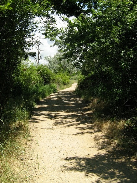
A section along the Grove Trail, part of the intertwining network of trails in
the Ridge to Rivers system, which mostly follows a lush and shady creek.


Geocaches Attempted

Traditional CacheALWAYS DARK Found
Traditional CacheLower Hulls Gulch Trail # 1 Found
Traditional CachePFJ Cache Found
Traditional CacheT's Trek #3 Found
Traditional CacheT's Trek #4 Found
Unknown CacheT's Trek #5 Passed

GPS Info

We collected all of the following data from our GPS unit during the adventure:

Maps

This Google Map is provided by GPS Visualizer

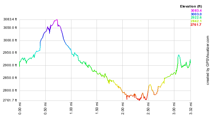
Elevation Profile


This profile is provided by GPS Visualizer

Coordinates and other details

  • Mileage: 
  • Time: 
  • Average Speed: 
  • Trailhead Coordinates: 
3.3 Miles
2:07:19
2 MPH
"Geocaches Attempted" links above contain coordinates, or GPX file below has waypoints to each cache.


If you would like to use this info with your GPS unit, the full GPX file is here.
If you want to view this in Google Earth, you can download the KMZ files of the track and topographic overlay.

Saturday, September 27, 2008

Emmett Geocaching


On a beautiful fall day, we decided to go up to Emmett, Idaho for some geocaching.  We had a successful trip, finding all 12 geocaches that were attempted, deferring the attempt on four of them due to location--we decided to get the biggest bang for the buck.  We even brought Grandma Jo along with us to help find some of the geocaches.  Every member of the family found at least one cache, and Grandma found at least three of them herself.  All of the pictures from the trip can be found here.


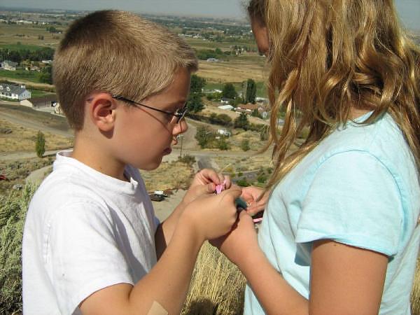
Amelia and Raymond examine the contents of a cache on Freezeout Hill, above Emmett, Idaho.


Geocaches Attempted

Traditional CacheA Bridge No MoreFound
Traditional CacheCan I hear Niagra?Found
Traditional CacheCobblestone OverviewFound
Traditional CacheCobblestone ParkFound
Traditional CacheCobblestone TrioFound
Traditional CacheGot Bicycle Parts?Found
Traditional CacheGOT CANCER?Passed
Traditional CacheI SEA NEMOPassed
Traditional CacheJAG - It's Just a GamePassed
Traditional CacheOld Freeze Out RoadFound
Traditional CachePayette River OverlookFound
Traditional CachePet Cemerety ????Found
Traditional CacheRim with a View #9Found
Traditional CacheRoad by the RiverPassed
Traditional CacheThomas' First HideFound
Traditional CacheThorny OneFound

GPS Info

We collected all of the following data from our GPS unit during the adventure:

Maps


This Google Map is provided by GPS Visualizer

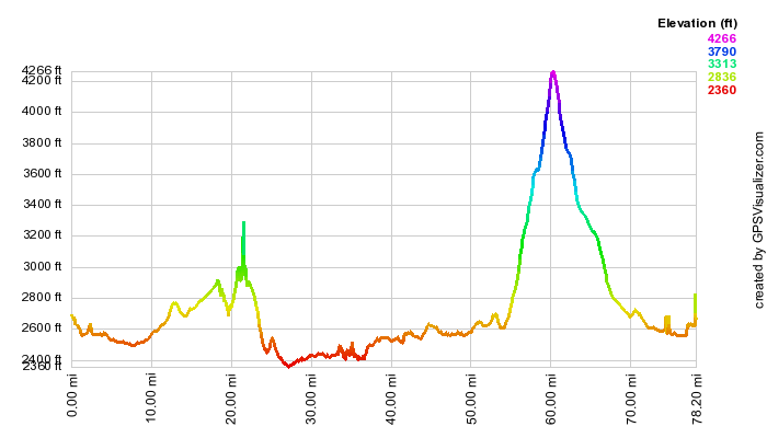
Elevation Profile


This profile is provided by GPS Visualizer

Coordinates and other details

  • Mileage: 
  • Time: 
  • Average Speed: 
  • Trailhead Coordinates: 
78.2 Miles
4:34:37
17 MPH
"Geocaches Attempted" links above contain coordinates


If you would like to use this info with your GPS unit, the full GPX file is here.
If you want to view this in Google Earth, you can download the KMZ files of the track and topographic overlay.

Friday, August 1, 2008

Glacier Waterton International Peace Park

 "Third time's a charm!" That's exactly how many times it took us to get to Glacier National Park in Montana, and it was more than worth the wait.  When we first tried to visit the park last August, we found ourselves needing to change plans just a couple of days away from the start of our vacation.  With all of the lightning-induced fires that had plagued Idaho and Montana last summer, we took one last look at the webcams in the park, and decided that it just wasn't going to be an enjoyable trip with all of the smoke up there.

No problem... we'll just go in June next time to beat fire season, right?  Wrong!  By the end of June, the Going-to-the-Sun (GTTS) Road was still closed due to snow.  Wow!  What a difficult park to visit, and what a narrow window of opportunity between snow and fire.  So, we waited out one more month of the summer, and finally made it!

In ten days, we put 1500 miles on the car: 500 to get to the park, 500 driving around there, and 500 to get back.  Even so, Glacier may be one of the least-geared National Park's for driving.  The GTTS disects the park going east-to-west, but to really see the park, you need to get out on the trails.  The park has about 100 miles of well-travelled roadways, and about 700 miles of trails.  That's why we ended up hiking nearly 40 miles, with a total elevation gain of over 5400 feet.  Total climb distance (all of the ups between the low and high elevation of each hike) was around 9000 feet!  No wonder the kids were complaining by the time we were done!  Amelia and Raymond were real troopers both on the trail and in the car... particularly during that 13-hour dash home.

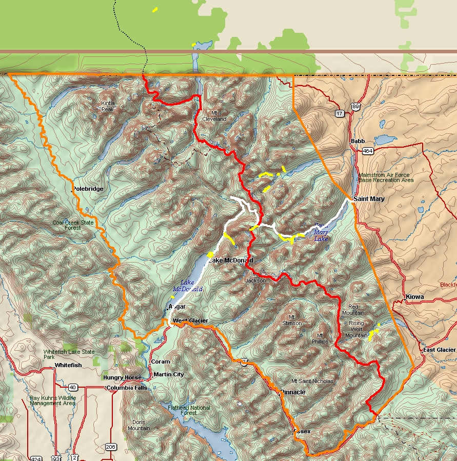
The following map of Glacier comes from of Delorme Topo USA. The legend for the map is:
  • Park boundary (orange)
  • Continental Divide (red)
  • Going to the Sun Road (white)
  • Hikes we took (yellow) [including two hikes north of the 49th parallel... i.e. Canada]


Highlights

While there were plenty of scenery to enjoy at many turnouts along the roads, we found that you really do have to hike to see the beauty of this park.  It is logically divided up into glaciated valleys, as follows.  Numbers indicate the hike as shown on the map linked to in the main bullet heading.Here is a map for each of the five areas courtesy of GPS Visualizer:


Lowlights

It's hard to complain about the beauty of Glacier, or how well the vacation went in general, but here is a small list of complaints:
  • Even with 6 lodging establishments and over 1000 campsites, the campgrounds are packed!  You gotta act fast if you want to get a campsite.
  • Campsites can be a bit tight at many of the campgrounds.  We had a hard time finding good campsites that would accomodate our tent.
  • We wanted the weather to cooperate with us 100% of the time... but we happily settled for 90%.
  • Not that we didn't expect it, but the insects can be pretty annoying--not to mention tenacious!
  • This is one very busy park.  We found very few opportunities to be away from massive crowds, even though this park is very far away from any major population.  We did find that Waterton Lakes National Park... Glacier's partner in Canada, was much less visited, but still highly enjoyable.

Favorites

Here's what each family member said was their absolute favorite activity of the trip:

Raymond:Shuttle Bus on GTTS Road
Amelia:Shuttle Boats on Swiftcurrent, Josephine Lakes
Suzanne:Redrock Falls Hike
Mike:Best Picnic Spots ever! (Avalanche Lake, Grinnell Lake, Paradise Point, & Redrock Falls)


Takeaways

Here are a few final thoughts from our vacation:
  • Wildlife.  Glacier National Park is truly wild!  No wonder they beat it into car campers to put EVERYTHING away that could potentially attract bears into the campgrounds.  We saw deerelkmoosebearbighorn sheep, and even the cute hoary marmot.  
  • We thought we were totally fulfilled after seeing the juvenile grizzly that bounded across the road in front of our car in Canada, but when we saw a full-sized grizzly bear come directly at us out of the brush about 30 yards away from our trail... well, that gave us quite a start!  Needless to say, we got ourselves as quietly as possible up the path before snapping a couple of quick pictures and moving on.
  • We'd just learned the night before about the mischeivous marmot, so when we saw the little rodent sneaking around the shuttle boat shelter where unsuspecting park visitors left there belongings while waiting on the shore of the lake, we knew exactly what he was up to.  No sooner could we alert the group of people about the marmot's presence, we turn to see the guy quickly hauling off his prey--the defenseless sweatshirt never knew what hit it.  Being closest to the critter, I bolted after him and was able to pluck it from him before he disappeared around the corner and restored it to its proper owner, who couldn't help laugh at the antics of the overstuffed squirrel.
  • Walking back from Red Rock Falls, we noticed a couple approaching us from down the trail.  Compleletly unaware, we noticed a large object move across the trail behind them.  Through the trees, there was no mistaking the distinct profile of a female moose, right where another trail went off to Fishercap Lake.  We slowly and quietly wandered down the path, but never again saw the moose until we got to the shore of the lake, where a crowd of awe-struck spectators where already starting to watch the moose amble out into the shallow lake for some feeding.  Across the lake, we could hear at least one more moose groan under the protection of a thicket of trees.
  • The bighorn sheep was a ewe that we saw right in the parking area of the Many Glacier Hotel.  She was just grazing there right beside our car as we drove by.  In fact, we had to proceed carefully, because she was right in the road for a moment and we weren't sure that she was going to stay out of the way.  Animals have little fear of people when they are protected by National Park status.
  • Breath-taking scenery.  We don't expect our pictures will do much justice to the magnificence of the scenery.  Rushing creeks, pounding waterfalls, massive glaciated valleys, gorgeous hanging valleys, rocks of every color, steep and jagged mountains, and turquoise-colored lakes kept our jaws dropped for the entire trip.  In fact, in many settings, we couldn't get the scene in one picture, so we took nearly 30 panoramics and stitched them together afterwards with hugin.
  • Weather.  From hazy to crystal clear; still air, to gusty wind; rain, hail and abundant sunshine.  Expect everything when you're in glacier...  As they say, "if you don't like the weather, just wait."  We were blessed with mostly excellent weather, but never did get to see Logan Pass on the Continental Divide with any sunlight on it.

Photos

As you've come to expect from the Lewis Family, there are loads of pictures to wade through from our vacation.  We found so many panoramic scenes, that we snapped more pans on this trip than any other.  Thank goodness for hugin, which allows us to easily piece together panoramas from multiple pictures!  It's a real lifesaver!  We've uploaded the following five albums consisting of 325 pictures!  
There were so many photogenic views, that pictures just seemed to take themselves.

Washington to Florida

After living in Washington state for 17 years, we decided to move to the extreme opposite end of the country to be with Mia and Mike as they...