For our final preparation hike, BSA troop 655 hiked to Otter Falls in the Mt. Baker-Snoqualmie National Forest near North Bend, WA. Otter Falls plunges 1200 feet from its precipice, although only 500 feet is visible from Lipsy Lake, where the falls tumble to an end down a 50-degree rock slide. In one survey, Otter is considered to be a top-100 waterfall (among a list of over 4000) in the Pacific Northwest. This hike was specifically chosen to mimic conditions we might experience on our high-adventure activity--lots of miles with little elevation gain.
We endured a pothole-filled (and in one spot a nearly-washed-out) forest road and drizzly rain for much of the hike to Big Creek Falls, where we ate our lunch during a break in the precipitaiton. Impressive in its own rights, Big Creek tumbles 238 feet down a series of rock steps until disappearing under an old forest road bridge. Once we had refueled, we continued back down the trail and took a poorly marked but short spur trail to Otter Falls. While admiring the falls, a light rain began to fall again, spurring us back to the trailhead. Because of the weather, only the hardiest of day hikers were spotted along the trail, including another scout troop from Bainbridge Island also preparing for a 50-miler this summer. All along the trail, the salmonberries were beginning to ripen. One could trust in a fairly tasty natural treat by testing each berry to make sure it wasn't too firm. I wouldn't trust returning to collect any there, however, as one of our scouts tried to pick the bushes bare by the end of the day. (You know who you are, Joseph Boss!)
Here is a link to all of the pictures I took. There weren't as many pictures from this trip... it's hard to be motivated to pull out the camera when it's raining.

From little Lipsy Lake, only 500 feet of the 1200-foot tall Otter Falls is visible to hikers.
GPS Info
We collected all of the following data from our GPS unit during the adventure:Maps
This Google Map is provided by GPS Visualizer
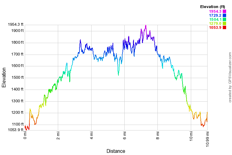
This profile is provided by GPS Visualizer
Elevation Profile
This profile is provided by GPS Visualizer
Coordinates and other details
| 11.0 Miles 5:44:52 (total), 4:44:56 (moving) 1.91 MPH (total), 2.30 MPH (moving) 47 33'39.5"N 121 31'55.9"W |


No comments:
Post a Comment