To prepare for our 50-mile high-adventure activity this summer, BSA troop 655 had planned on backpacking Park Butte, but this plan fell through due to the amount of snow still on the ground in the North Cascades. Instead, we went to Greider Lakes near Spada Lake. We needed something lower elevation, yet still close to home, and this hike fit the bill very well indeed. We assumed this hike was not very popular. None of us had heard of it, and it's on DNR land that's a bit off the beaten path. True enough, we didn't see anybody when we hiked in on Friday night, but good golly did the day hikers show up in force on Saturday morning. But, who's to blame them for such an amazing hike along Spada Lake, past lovely cascading creeks, and two pristine alpine lakes. As evidence of the merit of this hike, I submit exhibit A: the photo album.

Little Greider Lake Reflection.
GPS Info
We collected all of the following data from our GPS unit during the adventure:Maps
Elevation Profile
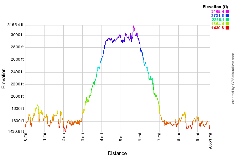
This profile is provided by GPS Visualizer
Coordinates and other details
| 8.9 Miles 6:24:17 (total), 4:23:57 (moving) 1.39 MPH (total), 2.03 MPH (moving) 47 58'25.5"N 121 36'57.0"W |
If you would like to use this info with your GPS unit, the full GPX file is here.
If you want to view this in Google Earth, you can download the KMZ files of the track and topographic overlay.


No comments:
Post a Comment