Here is a link to all of the photos we took on the hike.

Heather Lake from a scramble up the slope of the cirque that envelopes the lake. We climbed up to get a closer look at all of the waterfalls coming off the steep slopes of Mount Pilchuck.
GPS Info
We collected all of the following data from our GPS unit during the adventure:Maps
This Google Map is provided by GPS Visualizer
This profile is provided by GPS Visualizer
If you would like to use this info with your GPS unit, the full GPX file is here.
If you want to view this in Google Earth, you can download the KMZ files of the track and topographic overlay.
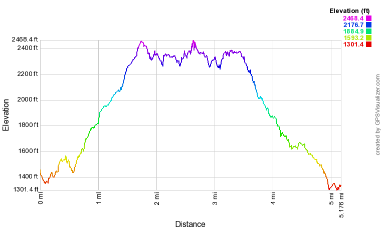
Elevation Profile
This profile is provided by GPS Visualizer
Coordinates and other details
| 5.2 Miles 2:44:08 1.89 Miles/Hr. N48 04.985' W121 46.338' |
If you would like to use this info with your GPS unit, the full GPX file is here.
If you want to view this in Google Earth, you can download the KMZ files of the track and topographic overlay.


No comments:
Post a Comment