Mike went with a group of scouts on a backpack trip to Annette Lake in the Cascade Mountains as a part of their preparations for a 50-miler this Summer. Unfortunately, it was a very small group who were able to make it (two to be precise), which was a shame because it was a beautiful hike, and we enjoyed sunny weather this weekend. Suzanne and I hiked the trail the weekend before this outing, in order to assess trail conditions and provide details to the scouts as they prepared. Amazingly, the lake was completely frozen over when we went, but it had almost entirely thawed just one week later, as seen from the photo below!
 |
Photos
Here is an online album of photos.
GPS Info
Unfortunately, I only collected the GPS data for the trip into the lake, so the mileage reported would need to be doubled for a 7.0 mile round trip hike. Here is the GPS data:Maps
Elevation Profile
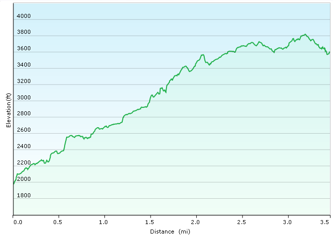
This profile was created using Garmin BaseCamp.
Coordinates and other details:
| 3.5 Miles (one way) 1:48:39 (up) / 1:36:00 (down) 1.8 MPH (up) / 2.2 MPH (down) N47 23.571, W121 28.451 |
If you would like to use this info with your GPS unit, the full GPX file is here.
If you want to view this in Google Earth, you can download the KMZ files of the track and topographic overlay.


No comments:
Post a Comment