During the winter break, we took a trip to Lake Wenatchee to spend a couple of days in the snow. Our family friend, Dale Partna, was nice enough to let us stay in his cabin for two nights after Christmas and we had a blast in the snow. On one outing, we checked out the tubing hill at the Leavenworth Winter Sports Club. It was about 30 degrees, but we bundled ourselves up and enjoyed the outing--at least until Suzanne bruised her bottom as she bounced too hard in the tube during one run, and the kids started complaining about headaches. While we didn't take any pictures, we did want to show our GPS data that shows the drop and speed of the run, coming down the 500-foot long hill that drops about 100 feet to the bottom. It wasn't as much fun as the tubing hill at Bogus Basin, but it was still enjoyable.
GPS Info
We collected all of the following data from our GPS unit during the adventure:Maps
Elevation Profile
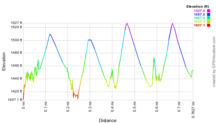
This profile is provided by GPS Visualizer
Speed Profile
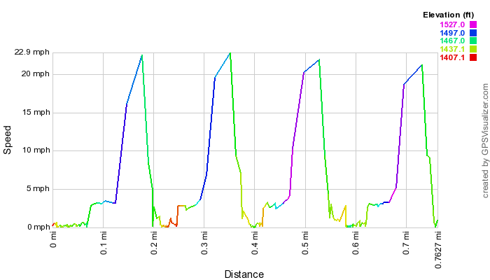
This profile is provided by GPS Visualizer
Coordinates and other details
| 0.8 Miles |
If you would like to use this info with your GPS unit, the full GPX file is here.
If you want to view this in Google Earth, you can download the KMZ files of the track and topographic overlay.


No comments:
Post a Comment