The land on which Ponderosa State Park sits may be some of the most coveted and beautiful in Idaho. Sitting on the 2.5 mile long peninsula on gorgeous Lake Payette, there are several miles of trails for hiking and biking in the summer, as well as for nordic skiing and snowshoeing in the winter. Driving to the end of the peninsula, we were treated to some wonderful panoramic views of the lake and McCall, Idaho from the 300-foot tall basalt cliffs. While there, we also took a brief hike around part of a lily marsh, but considering how warm it got, we couldn't endure much more than 1/2 mile.
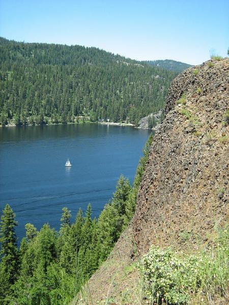
A sailboat floats on the Narrows of Payette Lake below Ponderosa State Park
GPS Info
We collected all of the following data from our GPS unit during the adventure:Maps
This Google Map is provided by GPS Visualizer.
This profile is provided by Delorme Topo USA.
If you would like to use this info with your GPS unit, the full GPX file is here.
If you want to view this in Google Earth, you can download the KMZ files of the track and topographic overlay.
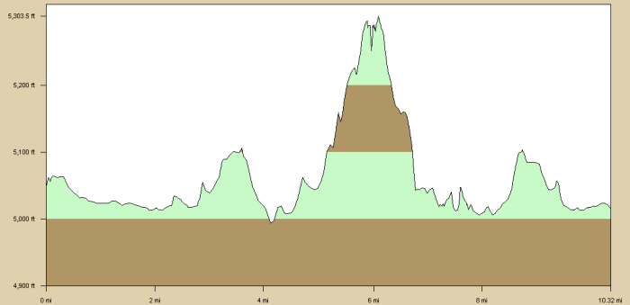
Elevation Profile
This profile is provided by Delorme Topo USA.
Coordinates and other details
| 10.3 Miles 01:21:04 8 Miles/Hr. |
If you would like to use this info with your GPS unit, the full GPX file is here.
If you want to view this in Google Earth, you can download the KMZ files of the track and topographic overlay.


No comments:
Post a Comment