During the winter break, Mike took Amelia & Raymond snowshoeing near Idaho City. They found a nice loop trail that wandered through the snow-covered forest. Fortunately, it was a short trip, because both of the kids complained about getting cold--it was about 20 degrees
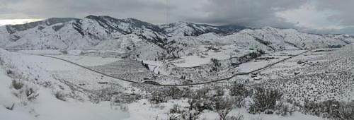
A seven-frame panorama from the ridge on the hike. The turnout on the road in the middle of the picture is where this adventure started. (Click on the picture to see it in full size.)
GPS Info
Mike collected all of the following data from our GPS unit during the adventure:Maps
This Google Map is provided by GPS Visualizer
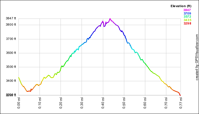 This profile is provided by GPS Visualizer
If you would like to use this info with your GPS unit, the full GPX file is here.
If you want to view this in Google Earth, you can download the KMZ files of the track and topographic overlay.
Elevation Profile
This profile is provided by GPS VisualizerCoordinates and other details
| 0.8 Miles 1:22 0.6 Miles/Hr. N 43º 37.608 W 115º 59.278 |
If you would like to use this info with your GPS unit, the full GPX file is here.
If you want to view this in Google Earth, you can download the KMZ files of the track and topographic overlay.


No comments:
Post a Comment