After our vacation to the Sawtooths, Suzanne claimed this hike as her favorite activity of the trip. It was a pleasant hike mostly along a creek that eventually opened up into a panoramic meadow with views of the Sawtooth Mountains from behind Redfish Lake.
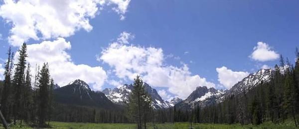
Two-frame panorama of the Sawtooth Moutains from Fishhook Meadows. An entrance to the
Sawtooth Wilderness Area begins here, and we hiked a little way into it.
GPS Info
We collected all of the following data from our GPS unit during the adventure:Maps
This Google Map is provided by GPS Visualizer
This profile is provided by GPS Visualizer
If you would like to use this info with your GPS unit, the full GPX file is here.
If you want to view this in Google Earth, you can download the KMZ files of the track and topographic overlay.
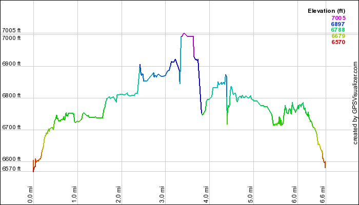
Elevation Profile
This profile is provided by GPS Visualizer
Coordinates and other details
| 6.6 Miles 4:33:37 1.5 Miles/Hr. N 44º 08.864, W 114º 55.181 N 44º 08.320, W 114º 58.220 |
If you would like to use this info with your GPS unit, the full GPX file is here.
If you want to view this in Google Earth, you can download the KMZ files of the track and topographic overlay.


No comments:
Post a Comment