
Either way, Hidden Springs does offer some nice early-season hiking trails with views of the surrounding foothills, and some geocaching opportunities to boot.
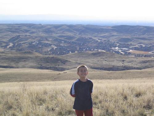
Raymond stands in front of a view of the Hidden Springs subdivision and the Treasure Valley in the far distance
GPS Info
We collected all of the following data from our GPS unit during the adventure:Maps
This Google Map is provided by GPS Visualizer
Profiles
Track #1:
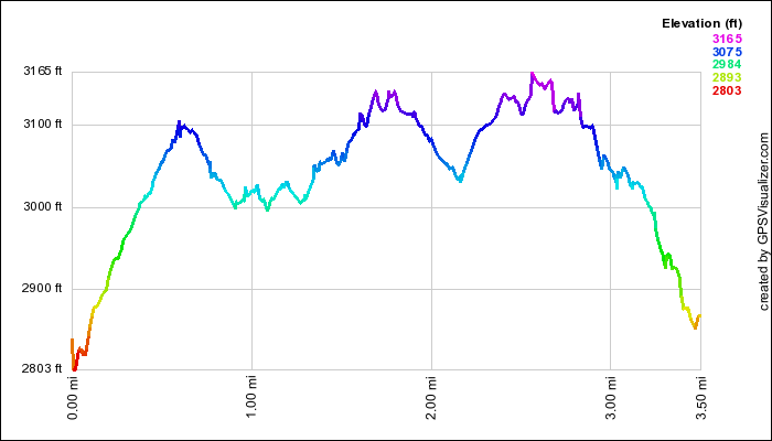
This profile is provided by GPS Visualizer
Track #2:
This profile is provided by GPS Visualizer
If you would like to use this info with your GPS unit, the full GPX file is here.
If you want to view this in Google Earth, you can download the KMZ files of the track and topographic overlay.
Profiles
Track #1:
This profile is provided by GPS Visualizer
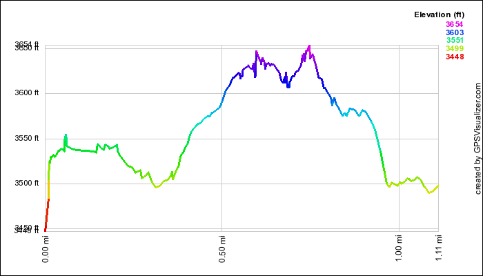
Track #2:
This profile is provided by GPS Visualizer
Coordinates and other details
| 3.5 Miles 2:00:39 1.75 Miles per Hour N 43 43.525, W 116 14.869 |
| 1.1 Miles 1:18:14 0.9 Miles per Hour N 43 44.378, W 116 13.568 |
If you would like to use this info with your GPS unit, the full GPX file is here.
If you want to view this in Google Earth, you can download the KMZ files of the track and topographic overlay.


No comments:
Post a Comment