Typically, when we plan our vacations, we have a set of things that we'd like to do and see. The Yankee Fork Drive (a.k.a. Custer Motorway) was not on that list when we left for our Sawtooth vacation. In fact, we hadn't ever heard of the Yankee Fork before we left. Instead, it was a very spontaneous trip that we made after finding some signage along the Salmon River Scenic Byway. It turned out to be one of the most pleasant and enjoyable aspects of our trip.
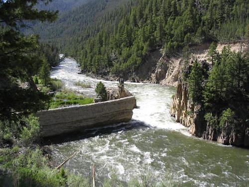
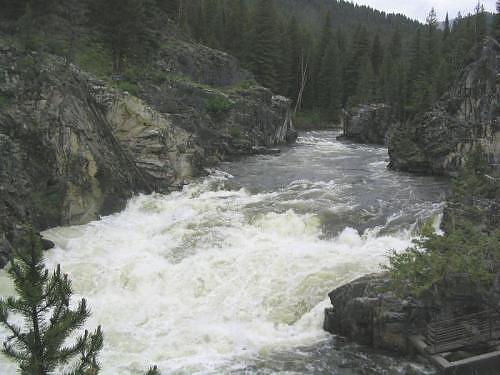
Ghost towns, old cemetaries, historic stories, mining equipment, and a museum in an old school house were delightful components of the drive. Gold mining scars from old-time dredging are notably obvious all along the Yankee Fork of the Salmon River.
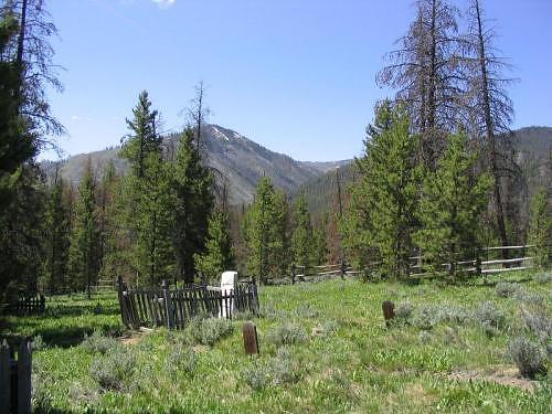
Wooden grave markers are scattered amongst some more modern tombstones
depict the harsh lifestyle of the gold mining town of Bonanza, Idaho.
GPS Info
We collected all of the following data from our GPS unit during the adventure:Maps
This Google Map is provided by GPS Visualizer
This profile is provided by GPS Visualizer.
If you would like to use this info with your GPS unit, the full GPX file is here.
If you want to view this in Google Earth, you can download the KMZ files of the track and topographic overlay.
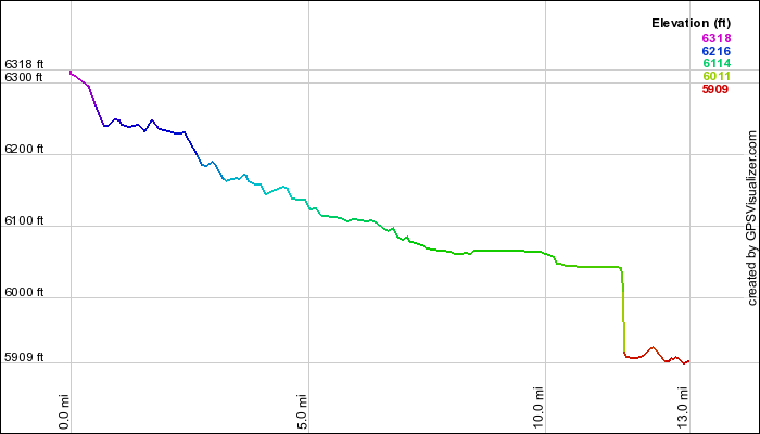
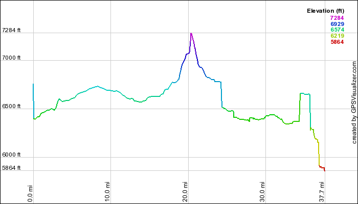
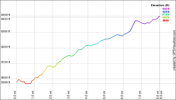
Elevation Profile
This profile is provided by GPS Visualizer.
Coordinates and other details
| 8.0 Miles 18:03 27 Miles/Hr. N 44º 16.249, W 114º 44.082 N 44º 22.355, W 114º 43.633 |
If you would like to use this info with your GPS unit, the full GPX file is here.
If you want to view this in Google Earth, you can download the KMZ files of the track and topographic overlay.