Along with three other adult leaders, we took BSA unit 655 on a snowshoe trip to Kelcema Lake along the Mountain Loop Highway. With the exception of a couple of young men, very few of the twelve boys who came along had ever snowshoed before. We had a great day enjoying the beautiful scenery, even though it was a more rigiorous adventure than most were expecting. Originally, we had planned on hiking to the Big Four Ice Caves, which would have been an easier itinerary, but that hike was closed due to avalanche danger, so rather than hike along the road which didn't really need any snowshoes at all, we decided to hike along Deer Creek Road (NF-1042). With 1700 feet of elevation gain, we definitely found enough snow to strap on the showshoes. The 10 mile round-trip hike took six hours to complete, but it didn't feel that long (although some of the scouts might debate that.)
When we started out, I told our scouts that we had 4.5 miles to reach the lake, but that we would hike for 2.5 hours and then turn around if we couldn't make it all the way in that period of time. We were at the 2.5 hour mark when the entire group had caught up to an icicle-laden rock wall that the boys were having fun with. I told them that we still had about a mile to get to the lake, and that we could turn back as promised. I asked who wanted to continue on to the lake, and nearly every one of them pressed forward! I was proud of these young men for their determination to press on to their final goal even though it was hard work.
Photos of the boys and the scenery are posted online here.

Scout leader, Adam Robinson, stands above the Kelcema Lake trailhead sign, indicating the snow depth.
GPS Info
We collected all of the following data from our GPS unit during the adventure:Maps
Elevation Profile
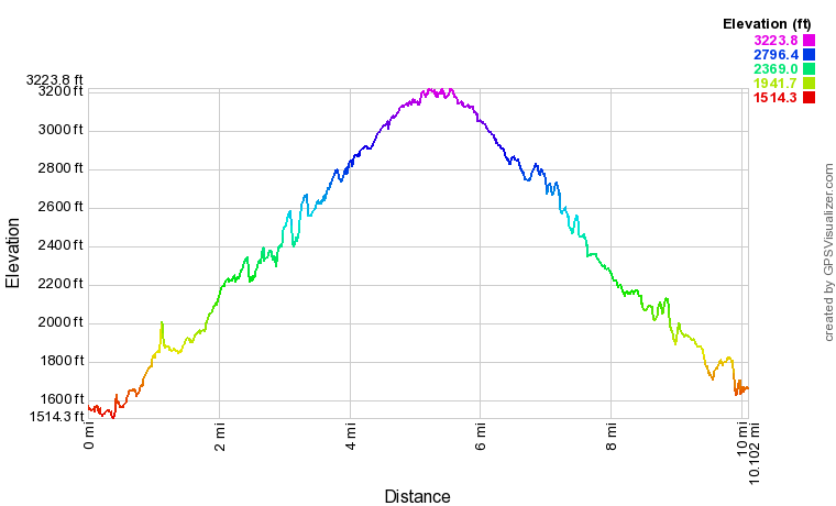
This profile is provided by GPS Visualizer
Coordinates and other details
| 9.8 Miles 5:41:39 1.73 Miles/Hr. 1710 Feet N48 05.092' W121 33.144' |
If you would like to use this info with your GPS unit, the full GPX file is here.
If you want to view this in Google Earth, you can download the KMZ files of the track and topographic overlay.


