As a new (and very out-of-shape) scout leader, my first backpacking trip with the varsity team of unit 525 was to one of the most beautiful glacial-fed lakes in the Cascade Mountains. More popular as a day hike (there aren't many developed campsites around the lake), Blanca Lake in the Henry M. Jackson Wilderness is absolutely idyllic. The hike is an absolute grind however, with dozens of switchbacks climbing up 2600 feet of elevation gain..... in just two miles.
If you want to see just how photogenic this lake and hike were, just point your browser here.

The Cascades reflect off of glass-like conditions on the Blanca Lake. The green water comes from glacial silt deposited from the Columbia Glacier higher up in the Mountains
This Google Map is provided by GPS Visualizer
This profile is provided by GPS Visualizer
If you would like to use this info with your GPS unit, the full GPX file is here.
If you want to view this in Google Earth, you can download the KMZ files of the track and a topographic overlay plugin.
GPS Info
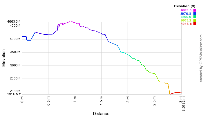
Unfortunately, I only got GPS data for the return trip, so total mileage reported needs to be doubled for a round trip trip of 6.0 miles. Also, the elevation profile below only shows the descent out of Blanca Lake, but not the hike in from the day before.Maps
Elevation Profile
This profile is provided by GPS Visualizer
Coordinates and other details
| 3.0 Miles 2:52:58 (total), 1:56:21 (moving) 1.05 MPH (total), 1.55 MPH (moving) 47 54'55.0"N 121 18'45.0"W |
If you would like to use this info with your GPS unit, the full GPX file is here.
If you want to view this in Google Earth, you can download the KMZ files of the track and a topographic overlay plugin.


