Before getting too hot on Saturday morning, we went to the Boise River Greenbelt and hunted for more geocaches, while enjoying a stroll along the river. It still got pretty warm even by noon, when we had got back to the car after our 2.6 mile hike... however, we were glad we got out early when we saw the mercury hit the century mark later in the day.
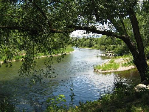
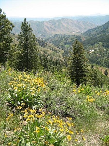
Boise River view from the Greenbelt in Eagle, Idaho.
Geocaches Attempted
GPS Info
We collected all of the following data from our GPS unit during the adventure:Maps
This Google Map is provided by GPS Visualizer
Time Profile
Since this was a relatively flat stroll along the river, an elevation profile is meaningless. However, we thought that a time profile might be interesting. In this profile, the steeper parts of the curve are where we were going much slower, or were stopped altogether. The red portions, for the most part, are where we were hunting for geocaches. By the time we got to the end of the greenbelt, you can see that we returned without doing nearly as much stopping.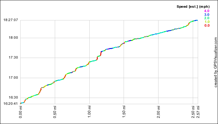
This profile is provided by GPS Visualizer
Coordinates and other details
| 2.6 Miles 2:06:26 1.2 MPH "Geocaches Attempted" links above contain coordinates |
If you would like to use this info with your GPS unit, the full GPX file is here.
If you want to view this in Google Earth, you can download the KMZ files of the track and topographic overlay.