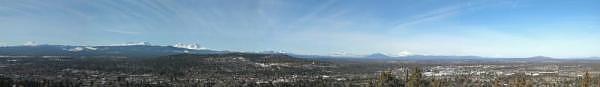
On our get-away to Oregon's Central Cascades, we took a snowshoe trip near Hoodoo Ski Resort. The snow was very icy, so we didn't have to worry about sinking into powder. We had magnificient views of a couple of peaks in the Cascades, as well a couple of downhill skiiers coming down the very steep backside of Hayrick Butte. The run drops an average of one foot of vertical distance for every two feet of horizontal distance. At the top, the angle is about 45 degrees! If you look closely enough, you can see the ski tracks here. You can see the full set of pictures from the outing here.
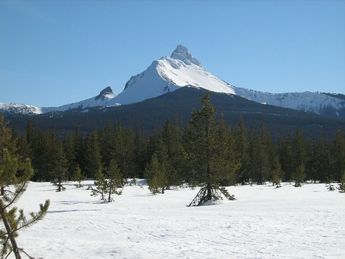
Mt. Washington from meadow on South Loop at Ray Benson Sno Park.
GPS Info
We collected all of the following data from our GPS unit during the adventure:Maps
This Google Map is provided by GPS Visualizer
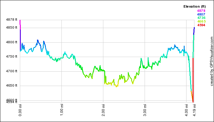
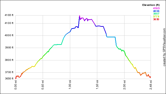
This profile is provided by GPS Visualizer
If you would like to use this info with your GPS unit, the full GPX file is here.
If you want to view this in Google Earth, you can download the KMZ files of the track and topographic overlay.
Elevation Profile
This profile is provided by GPS Visualizer
Coordinates and other details
| 4.2 Miles 02:25 2 Miles/Hr. N44 24.281 W121 51.723 |
If you would like to use this info with your GPS unit, the full GPX file is here.
If you want to view this in Google Earth, you can download the KMZ files of the track and topographic overlay.